
Area Hikes
Learn more about local hikes; brought to you by The Hike Shack
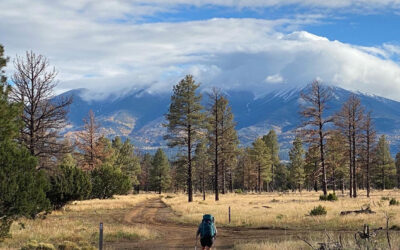
To the Mountains, I Will Go
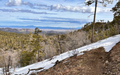
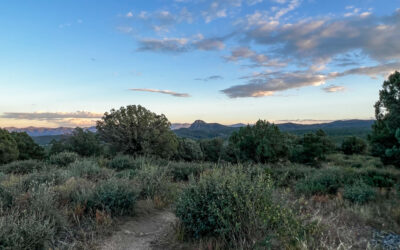
Last summer, I wrote about a trail extension in the works for the West Spruce Trail #264. It has finally connected to several other trails, making exploring the mountains southwest of town easier.
The old West Spruce Trail terminated near the Thumb Butte Loop Road cattle guard. Now, thanks to the completion of the extension, the 264 trail crosses the road and heads east.
The trail is mellow with little to no incline or decline as it wraps around the hillside, exposing more amazing views to the north. The trail winds around the hillsides for about a mile until you run into an intersection where hikers have four options from which to choose. The Sierra Pieta overlook is a mile to the south. Potts Creek is 1.5 miles in the other direction; old Forest Road 9401J will take you to the circle trail intersection on 327, and now you can go straight across and head another 2 miles towards Copper Basin Road and Forest Road 9402D, which will take you to the Mt. Francis Trails.
The Gateway Trail
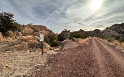
The Storm Trails in the heart of the Granite Dells now have a new access point. The Gateway Trail allows users to access the Peavine Trail just north of the Iron King intersection in just a half mile. The trail starts on Old Highway 89. When heading north on 89 out of Prescott, there is a right-hand turn just after Three Sisters Consignment that takes you past the trailer park to an area with some parking.
Well Worth the Drive
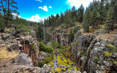
Sycamore Canyon Wilderness has so much scenic beauty to offer. It has many access points and many miles of trails surrounding it and in it. One of my favorite Sycamore hikes is the Sycamore Rim Trail. It is a bit of a drive to get to, but well worth the effort.
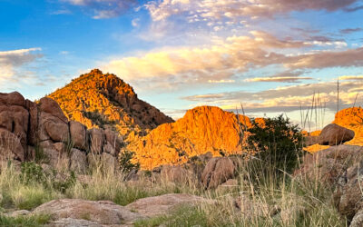
The Dells!
A New Set of ‘Incredibly Beautiful’ Trails Southeast of the Peavine/Iron King Intersection Provides Myriad Hiking Opportunities and Breathtaking Sights
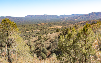
West Spruce Goes East
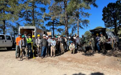
I recently had a conversation with Jason Williams, Prescott National Forest (PNF) Trails and Wilderness Manager, about what is happening with the trails out at West Spruce.
He told me the latest project is a new trail that will connect to the West Spruce Trail, which currently ends or begins on Forest Road (FR) 373 just before the cattle guard. I jumped in the truck and went to see how much they have accomplished.
To find this new trail, head past Thumb Butte about 1.8 miles, then turn left onto FR 373. Continue another 3.2 miles on the dirt road to a small parking area on the right, just before the cattle guard. This new trail takes off to the east and offers spectacular views as it twists and turns over two miles to Copper Basin Road.
This section of trail will be slightly narrower and more difficult than the Circle Trail.
A Loop for You!
If you are looking for a new adventure and haven’t done any exploring on the northwestern side of Granite Mountain, I have a loop for you. Fourteen miles out of Williamson Valley Road is the Almosta Ranch subdivision. Just a half-mile down Almosta Ranch Road, you’ll find a large parking area for the beginning of your exploration. Almosta Trail begins here and heads towards the western side of Granite Mountain. I took Almosta Trail to Lost Shoe and then Stringfeild back to Almosta to make about an eight-mile trek. Almosta Trail leads you through the end of the housing development and into the vast country full of pines, juniper, cactus, scrub oaks, manzanita, and even cottonwoods once you hit Mint Wash and Jerome Canyon.
Arizona in All its Glory
When Prescott residents Cal Seabaugh and Kelly Williams say they’ve seen Arizona, they mean it: the duo spent 45 days this past fall hiking the entire Arizona National Scenic Trail—all its 800 miles and 110,000 feet of elevation gain.
Stretching the length of the state, from Utah to the Mexican border, the trail, also known as the Arizona Trail, showcases Arizona’s diverse landscape. And, Kelly, said, “It’s all spectacular.”
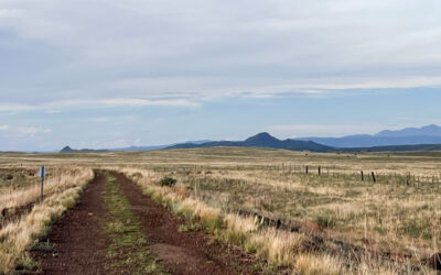
Introducing the Headwaters Trail
Just before the two-mile mark, look for the trailhead sign on the left. Headwaters Trail is 3.27 miles of single track that will take you back to the Peavine. It is a very flowy trail that winds though the grass and it is a great place to get some miles in. Eventually the trail curves back toward the new subdivision. The trail continues through the area on a dirt single track in a wash. The fences for homes keep them silent and almost hidden. Follow the well-marked signs and stay on the dirt single track until you arrive back at the Peavine. Now you are about a mile from the parking area. This approximately seven-mile round trip is kind of a long journey, but because it doesn’t involve climbing any mountains, it is easy to accomplish.
Ranch Trail #62 East Side
On a beautiful Sunday morning, I found myself struggling to leave my warm comfy bed and cup of coffee. Some days it is just hard to keep your chin up. I finally convinced myself not to waste the day and go for a hike to clear my head. I found myself heading to the Ranch Trailhead parking area just down Walker Road about a ¼ mile. I heard it had recently received some much-needed love.
Choose Your Own Adventure
When I was a kid I loved the choose your own adventure books. I would read them over and over until I had chosen every option possible. Spence Springs is a lot like those books. You can pick a starting point and create countless adventures.
One adventure I have enjoyed most recently is Vista, Noodle, Sidekick, Tatanka, Tunnel Vision, to the BLM. Spence Springs is now very well marked and at every turn there is not only a trail map but even a QR code so you can download the map and track yourself with your phone. Service in this area is quite good so even if you do manage to lose yourself it will not be hard to find you.
A Pleasant Surprise
The original Peavine Trail in Prescott is always a drier option, but it’s a little crowded these days. I heard Chino Valley had a new section of the Peavine rail trail ready to explore so I headed north on Highway 89. The trail materials on some of these old railroad beds make the trails a much less muddy option, and this is no exception: the Chino Valley section of the Peavine provided an almost completely secluded and mud-less hike just 10 minutes from Prescott.
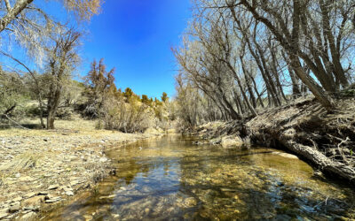
A Little Piece of Heaven
Watson Woods is a riparian preserve that has been called the rarest, and one of the largest streamside riparian habitats in North America.
I recently took my niece on a quick day trip to this area, and it provided us with just the piece of heaven we were in search of. With a limited amount of time before the temperatures soared over 90 degrees, we took an early morning journey to Watson Woods, 126 acres shaded by majestic cottonwood trees and lush vegetation along our very own Granite Greek.