
A community dream that took more than 25 years to become a reality, thanks to the work of many locals, the Prescott Circle Trail (PCT) opened in May 2015. This 54-mile loop around the City of Prescott comprises 25 miles of city trails and 29 miles of Prescott National Forest trails, with 600 feet of elevation change, accessible via 15 different trailheads.
There are endless ways to approach this system’s web of trails to create your own adventure. The entire PCT has been run in just less than eight hours and ridden on a mountain bike in six. It has been done as a multi-day backpacking adventure, and it has been hacked away, one section at a time.
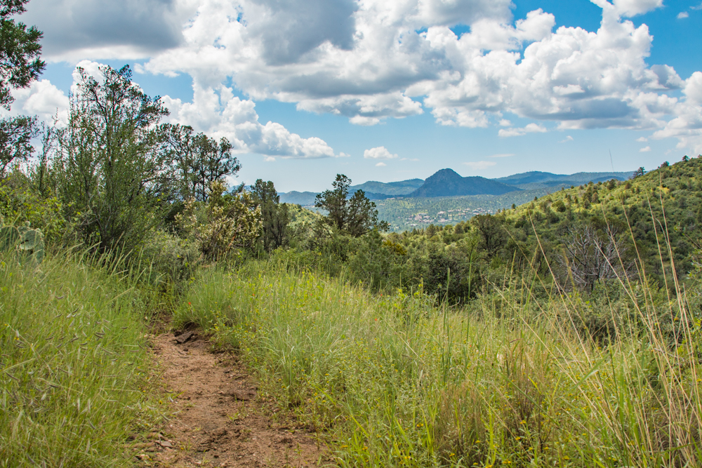
PCT emblems on trail markers mark the trails themselves.
The City of Prescott Trails and Outdoor Recreation Map (find it all over town) is an absolute must for your adventure. It marks the PCT with mile markers in a small circle.
You can use the Avenza maps app to download the map to your phone; scan the map QR code in this guide. Following are brief descriptions of trail sections including where to find parking, water, and camping.
Mile marker 0 is at the Peavine Trail parking lot ($3), which is off Prescott Lakes Parkway and has water, restrooms, picnic tables, and plenty of parking. Overnight parking is not permitted. The first mile winds around the west side of Watson Lake, to Watson Lake Recreation Area and Campground ($3 parking fee and additional camping fees; also, camping—reserved and first-come, first-served sites—is seasonal). Check the City website while planning; events at Watson Lake and can close the camping area to the public. There is plenty of parking in this area. Horse trailers are permitted. The next mile takes you across the street, past Twin Lakes Market.
Miles 2-5: This easy section wraps around the south shore of Willow Lake. There are several small, free, no-facilities parking areas along the trail on Willow Lake Road (facilities are available at Willow Lake Dog Park). These parking areas aren’t suitable for horse trailers. The summer months can make this section a little buggy, especially around sundown. Enjoy this section in any direction, year-round. Mile five goes under Willow Creek Road and onto Embry-Riddle’s Jan Alfano Trails. There is no access or parking at this road crossing.
Miles 6.5-11.5: This easier, low-elevation-change section runs through Pioneer Park (another great access point with tons of parking). Facilities are limited, and there is no camping. Leaving the park you’ll travel under Pioneer Parkway and wind over rolling hills for just under three miles, to Williamson Valley Road, where parking is very limited; however, there is a no-facilities parking area on the other side of Pioneer Parkway, up the hill from the light at the end of the trail.
Mile 12-part of 13: This is the only section of trail that’s not a trail. Cross to the west side of Williamson Valley Road and travel south to Yampa Drive. Turn right on Yampa, left on Hozoni, and right on Kahtan, where you’ll find the Granite Basin/Kahtan parking area (which doesn’t have any facilities). The trailhead is on the north side of Kahtan. This is a great spot for day access in a vehicle.
Miles 13-18: Getting back to single-track trail! Travel along the south side of Granite Basin Recreation Area. Trail 347 takes you to 341, which connects to 332. At the intersection of 332, a 0.4-mile detour down Trail 346 takes you to the Cayuse parking area, which requires a fee and provides ample parking, as well as bathrooms, drinking water, and seasonal camping sites at the Yavapai Campground. This trail section can vary in intensity and elevation change depending on direction and type of travel. You can see volcanic rock coves on sections of this trail. The view of Granite Mountain is fantastic! Trail 332 crosses Granite Basin Road at mile 16. There is a small parking area with no facilities. The next two miles have some good elevation gains as you climb out to Iron Springs Road.
Miles 18-22: This portion of Trail 332, known as the Javelina Trail, connects Iron Springs and Thumb Butte Roads. It consists of a rails-to-trails section on the northern side, and single-track on the southern side. The trail sign on the right side of the trail leads you off the wide, easy trail and back to a winding, rocky, single-track. There is no-facilities parking on the Iron Springs side (not suitable for horse trailers). On the Thumb Butte side, the generous White Rock trailhead parking lot (just off the PCT, 0.4 miles south on Trail 318) offers ample space for horse trailers. The grade climbs as you head toward Thumb Butte. If you are backpacking and prefer not to stay in a campground, just west of the White Rock parking lot, go left on Thumb Butte Road. A mile or so from the PCT, find several dispersed, no-reservations-required camping spots.
Miles 23-28: This section connects Thumb Butte and Copper Basin Roads. Watch closely for the PCT markers; this section’s many junctions make it confusing! Trail 332 crosses Thumb Butte Road and turns right to meet Trail 392 (Garden Grove Trail), which takes you over seasonal creek crossings, then up switchbacks to the Circle Connection Trail (322). Its 0.5 miles connects to Potts Creek Trail (327), where a left turn takes you to the Cold Spring Trail (393), which climbs over the ridge 1.5 miles to Copper Basin Road. The Copper Basin side has a small no-facilities parking lot. Unless we’ve had a good snow, this section is really beautiful.
Miles 28-34: Trail 48 starts on the south side of Copper Basin. Less than a mile in, take Trail 9415 and head for the pass between Wolverton and Quartz Mountains, and the highest point on the PCT. The grade is less coming from the Copper Basin side; the downhill slide can be pretty hard on the knees if you’re hiking. Mind your speed if you’re biking. Take your trekking poles, put on your helmet, or saddle up, and remember we share the trails! This section is rough and rocky no matter how you approach. It’s also well worth the view. The busy White Spar Campground is on the White Spar side of the trail. There is drinking water year-round, but the campground and other facilities are closed during winter. Make reservations on the Prescott National Forest website.
Miles 34-38: The four miles from White Spar to Senator Highway wind through the forest on the south side of Goldwater Lake. Trail 396 is a narrow, windy, shady, well-traveled single-track. It’s a good point-to-point or out-and-back. There are views of the lake and mountains and it offers an easier section of trail; however, this is not a fun section if weather is inclement. This trail has steep sides in some sections which can make it hard to pass on a busy day. A slight detour to the north just past the lake will take you to Goldwater Lake Park, which offers bathrooms and drinking water, and requires a parking fee (no overnight parking). There is free parking at the Water Shed Trailhead on Senator Hwy at the end of Trail 396.
Miles 38-47.5: Just south of the Goldwater Lake Park entrance on the left side of Senator Highway, a small dirt parking area marks the spot where you cross at the end of Trail 396, and the trailheads for both the spectacular Ranch Trail 62 (on your left) and The Water Shed Trail. The Ranch Trail winds through the Bradshaw Mountains. At mile 43.5 take a left on the Badger Mountain Trail. The elevation changes are mild; the tough part of this trail is the length. To break this section up, go left after mile 47.5 and head down to the Turley Trailhead parking lot. This is a small parking area with no facilities on Wells Fargo Road. The detour is less than a mile and is your only option for an access point for another four miles.
47.5 to 51.5: The Badger Mountain Trail connects to the Sundog Trail on the other side of Highway 69. Its switchbacks take you over Badger Mountain. I do not recommend it in the summer months (due to exposure and muddy conditions during monsoons). Consider taking a headlamp and enjoying a night hike or ride when the weather’s warm and dry. The Badger Mountain Trail goes under the highway and connects to the Sundog Trail. At mile 51, if you want to exit the PCT, go under the highway and take the dirt road to the car dealerships. The shopping center across the street offers plenty of parking (and you can grab a drink there).
51.5-55: The Sundog Trail is another exposed section of trail. Avoid it during the warmer months and during monsoons (as with any trail, if the trail is wet, save it for another day. Damage caused by use in muddy conditions creates countless repair hours for trail volunteers). If you don’t access this section from the dirt road behind the car dealerships, you can park in the Peavine Trail parking lot. This section winds through the grassy hills back toward Watson Lake. It can be a little steep in a few sections but the trail is not rough or rocky.
When conquering any section of this trail, bring extra water, good footwear, trekking poles, and hiking partners. If you plan to ride it, break it up any way that suits your riding skills. These trails are going to get busier and busier as the years go by. If you plan to make this an epic multi-day adventure, research your camping situation before you go, make reservations, and ensure there are no closures or restrictions in the Prescott National Forest. If you travel the PCT by horseback, remember your options for parking and water. Keep in mind these are high-use trails, especially if your horses are easily startled.
Lastly, our trails are built and maintained by countless volunteer hours. If you haven’t had the chance to volunteer, or help build and maintain a trail, there are lots of opportunities!
For information on trail work days, contact the Yavapai Trails Association, the Prescott Mountain Bike Alliance or the Prescott National Forest.